07 City Guides National park
Shenandoah National Park Road Trip: Skyline Drive
Last updated:
Summary
A Shenandoah National Park road trip follows Skyline Drive, a 105-mile road along the crest of the Blue Ridge and the only public road through the park, with hollows dropping away on both sides. This guide runs along the crest through the park's south, middle and north, with the entrances, the side hikes and the towns below. The Drive is generally open year-round but can close in storms, and most park facilities shut down by late November.
The road stays on the crest; the hollows fall away on both sides.
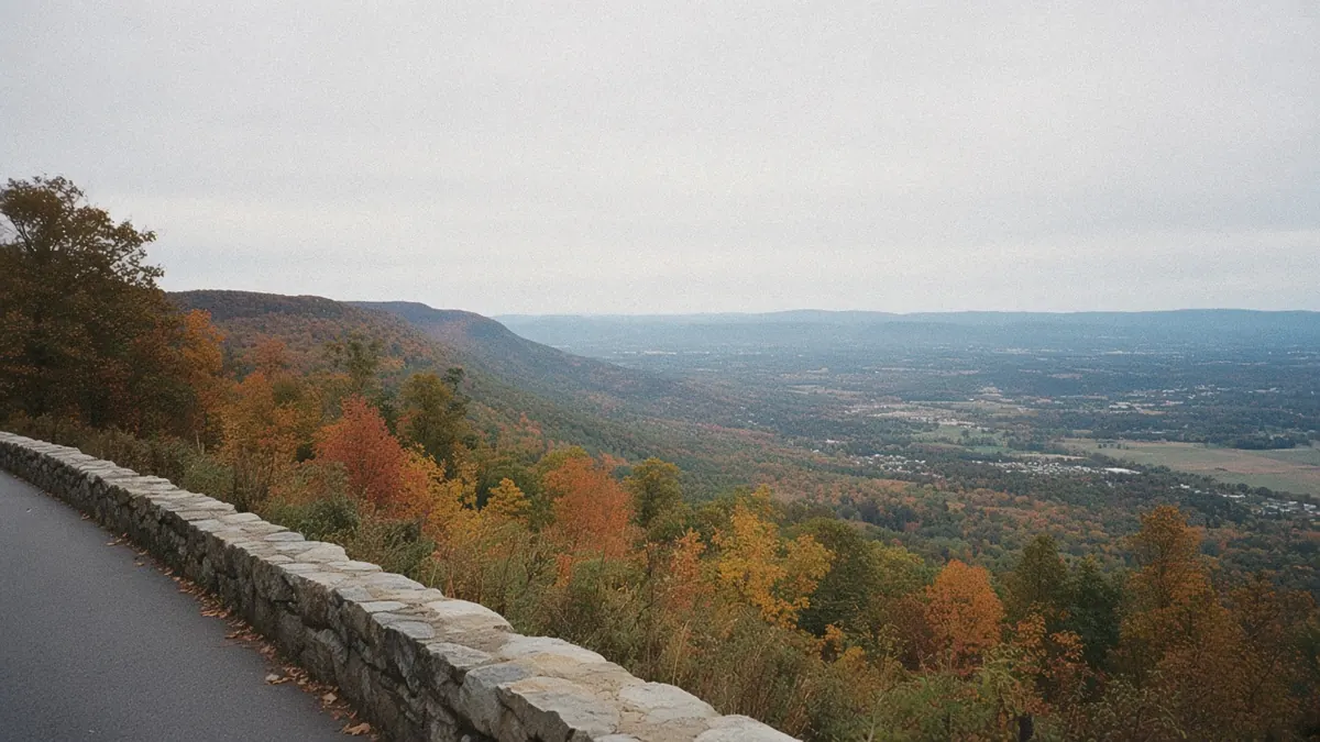
It’s late morning on Skyline Drive, and you’re driving along the spine of the mountains. On your left, the land drops off steeply into the Shenandoah Valley, a quilt of farm fields and small towns far below with a second ridge beyond. On your right, a wooded hollow folds down to the east, full of oaks and shadow, with no road anywhere in it.
The Drive itself just keeps going, curving north ahead of you and south behind you, never dropping off the ridgeline for long. You pass an overlook, then another, each opening onto a different side of the mountain.
Down in those hollows there are streams, waterfalls and old trails.
So why doesn’t a single road go down there, and what does that mean for how you plan the day?
Quick plan
- How long
- One full day on one stretch of the Drive, two if you want a second district or a long hike.
- Best months
- May, plus September into October; winter only if you watch the alerts.
- Skyline Drive
- 105 miles, generally open year-round but subject to weather closures; about three hours end to end with no stops.
- Getting in
- Four entrances: Front Royal, Thornton Gap, Swift Run Gap and Rockfish Gap. CHO is the closest small airport to the south entrance.
- Passes
- Every visitor needs an entrance pass; an America the Beautiful pass counts.
A Shenandoah National Park road trip, along the crest
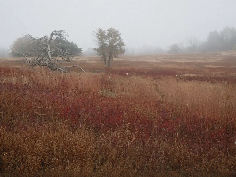
The answer to the opening question is the whole shape of the park. Skyline Drive is the only public road through Shenandoah, and it runs 105 miles along the crest of the Blue Ridge. There are only four places to drive on or off it. Everything else, including the hollows, the waterfalls and the deep woods, waits at the end of a trail, whether it starts beside the Drive or at an access point on the boundary.
The detail that reshapes most first plans is that this is one long line, not a loop. You drive in at one entrance and either come back the same way or leave by another, and the park says the full length takes about three hours on a clear day without stops. Add hikes and overlooks, and one district fills a day.
A simple way to divide it:
- One day from the south: enter at Rockfish Gap and drive north as far as Big Meadows, with a hike or two on the way.
- One day from the north: enter at Front Royal and drive south past Thornton Gap.
- Two days: pair the south and central districts, or start at Front Royal and drive south to the far end.
Either direction works; the mileposts start at zero in Front Royal and climb as you go south.
The crest is the road, and the rest of the park is a walk from it.
Getting there
Flying in: The nearest small airport is Charlottesville-Albemarle (CHO), about 9 to 10 miles from downtown Charlottesville, which is then about 24 miles from Rockfish Gap. Richmond is about 70 miles east of Charlottesville. Washington’s airports and Roanoke also work for readers already headed to one of them.
Driving in: The park has four entrance stations on Skyline Drive:
- Front Royal, the north entrance at mile 0, near I-66 and US-340.
- Thornton Gap, at mile 31.5 on US-211, near Luray.
- Swift Run Gap, at mile 65.5 on US-33, near Elkton.
- Rockfish Gap, the southern entrance at mile 104.6, by I-64 and US-250.
I-81 runs through the Shenandoah Valley west of the ridge. Skyline Drive hands off to the Blue Ridge Parkway at Rockfish Gap. The Parkway is its own road, gated separately for weather. Sections close seasonally and for repairs; check the road-status page before counting on a southbound drive.
The park also warns that GPS directions to it can be wrong, so follow its directions to each entrance.
Drive times (all approximate):
- Charlottesville to Rockfish Gap: about 24 miles, 25 to 30 minutes on I-64.
- Staunton to Rockfish Gap: about 16 miles, roughly 20 to 25 minutes.
- Charlottesville to Front Royal: about 74 miles, roughly 1 hour 35 minutes to 1 hour 50 minutes.
- Front Royal to the north entrance: just outside town.
Choose the entrance first, and the rest of the plan follows.
Skyline Drive, north, middle and south
Rockfish Gap and the southern district
The southern entrance at Rockfish Gap is where Skyline Drive begins its run north and the Blue Ridge Parkway begins its run south. The southern district is the quietest stretch of the Drive, with long views over the valley to the west and the Loft Mountain area, about 25 miles north of the entrance. Loft Mountain’s campground and services close for the season in early November.
Swift Run Gap
At mile 65.5, Swift Run Gap brings US-33 over the ridge between Elkton in the valley and the Piedmont to the east. It’s a handy way on and off the Drive, letting you cut the long southern half into shorter pieces or reach the central district from Charlottesville without driving the whole southern stretch.
Big Meadows and the central district
Big Meadows, at mile 51, is the park’s largest developed area: a broad, open meadow on top of the ridge, with a visitor center, a lodge, a campground, a wayside and picnic grounds, when they’re open. The wayside has the park’s only gas station. In 2026, the visitor center, lodge, wayside and campground were all scheduled to close for the season on November 29, though the picnic grounds stay open year-round. It’s the natural overnight stop on a two-day drive, in season.
Thornton Gap and the central crossings
At mile 31.5, Thornton Gap brings US-211 over the ridge from Luray in the valley. Just south of it, Skyline Drive passes through Marys Rock Tunnel, which has a maximum clearance of 12 feet 8 inches, worth knowing if you’re in a tall RV or trailer. Skyland, a lodge area farther south on the ridge, closed for the season on November 8 in 2026.
Front Royal, Dickey Ridge and the north district

The north entrance sits just outside Front Royal, at mile 0. A few miles up the road, the Dickey Ridge Visitor Center, at mile 4.6, is open year-round on a reduced weekly schedule, and its picnic grounds stay open too. This end of the park is the closest to the Washington area, so weekends can be busy.
Old Rag and the eastern slope
Old Rag is a rocky peak along the park’s eastern boundary, reached from a trailhead at the boundary rather than from Skyline Drive. From March 1 to November 30, hiking its Saddle, Ridge and Ridge Access trails needs an Old Rag day-use ticket, bought in advance, in addition to an entrance pass. It isn’t a spontaneous add-on to a Skyline Drive day, so plan it as its own outing.
Join the road at whichever gap suits the day, and the crest carries you on from there.
Weather closures, passes and the season’s calendar

There’s no fixed winter closure on Skyline Drive. Day and night it’s normally open, but inclement weather can close all or part of it at any time, and the park says it can take crews several days to reopen it after a winter storm. Even when the Drive is closed, you can still enter the park on foot at an entrance station or from a boundary access point. For updates, text SHENALERTS to 888777 to join the park’s alert system, and check its alerts page.
Facilities follow the calendar. Most open in March and close by late November. In 2026, the Byrd Visitor Center at Big Meadows closed for the season on November 29, while Dickey Ridge stays open year-round on a reduced schedule. The park hasn’t posted 2027 dates yet. Campground reservations for early 2027 were unavailable in mid-November while campground operations moved to a new concessioner, with booking expected to open in early January.
Every visitor needs an entrance pass, whether driving Skyline Drive or hiking in from the boundary. The park is cashless and takes only card or mobile payments. An America the Beautiful pass covers entry here, so if several parks are on your list, see when that annual pass pays for itself. The park has said it will begin installing automated entry stations at all four entrances in fall 2026. The Old Rag day-use ticket comes on top of the entrance pass in its season.
The rules are light, but the weather on the ridge makes its own.
Towns below the crest, and the best months

At the south end, Charlottesville gives you a whole city to sleep in, about 24 miles from Rockfish Gap; the Charlottesville page covers the city. Waynesboro and Staunton sit closer, in the Shenandoah Valley just west of the gap. Luray, below Thornton Gap, is the base for the middle of the park, and Front Royal is right at the north entrance.
The Drive’s peak seasons are late spring and autumn. Summer is green and busy on weekends, with hazy days now and then. Winter is possible when the road is open, but most lodges, waysides and visitor centers are closed, and the park says the ridge is usually 10 to 20 degrees colder than the lowlands. I’d go in May or between mid-September and October, on weekdays if you can, since autumn weekends fill the overlooks and an early snow can always arrive up high.
Sleep near the gap you’ll drive through at first light, and the crest is yours before the crowds arrive.
What to sort out before Skyline Drive

- Check the alerts the morning you go: With no fixed winter closure, a clear forecast in town doesn’t guarantee an open road on the ridge.
- Don’t try to do it all: The whole Drive is about three hours with no stops, so pick a district and hike instead.
- Match the entrance to the day: Rockfish Gap from Charlottesville, Front Royal from I-66, and Thornton Gap or Swift Run Gap to cut the crest into shorter pieces.
- Fill the tank before you enter: There’s only one gas station in the park, and in winter its pumps can be unreliable.
- Have your pass ready: Entry needs a pass, payment is card or mobile only, and the annual federal pass works here.
- Plan Old Rag separately: From March to November it needs its own day-use ticket in advance, plus a pass.
- Remember you can still walk in: If the Drive is closed, you can still enter on foot at the entrances and boundary access points.
- Treat the Parkway as a separate road: Check its own status at Rockfish Gap before you head south.
On the Blue Ridge and Smokies route
Blue Ridge and Smokies route: Knoxville to Shenandoah National Park. Previous: Charlottesville, about 24 miles west on I-64 to the south entrance at Rockfish Gap, roughly 25 to 30 minutes.
Pair it with:
- Charlottesville: a university city about half an hour east of Rockfish Gap.
- Staunton and Waynesboro: valley towns just west of the south entrance.
- Luray and Front Royal: towns below the middle and north ends of the Drive.
Drive the crest north to south, or south to north?
Sources
Common questions
How do you plan a Shenandoah National Park road trip on a first visit?
Pick an entrance, then pick a stretch of Skyline Drive rather than trying to cover all 105 miles with hikes. From Charlottesville, start at Rockfish Gap and drive north to Big Meadows; from the Washington area, start at Front Royal and head south. A second day lets you add another district or a long hike.
Is Skyline Drive open in winter?
Generally, yes. There's no fixed winter closure, but snow and ice can close all or part of the Drive at any time, and the park says reopening after a storm can take several days. Most lodges, waysides and visitor centers close by late November. Text SHENALERTS to 888777 for closure alerts, and check the park's alerts page before you go.
How long does it take to drive Skyline Drive?
The park says it takes about three hours to travel the whole 105 miles on a clear day. That's without stops, at a speed limit of 35 mph in most places. Add overlooks, a hike or two and lunch, and the full length easily fills a day.
How do you get to Shenandoah National Park from Charlottesville, Front Royal or I-81?
From Charlottesville, take I-64 west about 24 miles to the south entrance at Rockfish Gap. The north entrance is just outside Front Royal, by I-66 and US-340. From I-81 in the Shenandoah Valley, cross the ridge at Rockfish Gap on I-64, at Swift Run Gap on US-33 or at Thornton Gap on US-211.
Do you need a reservation or an extra ticket for Shenandoah National Park?
As of mid-November 2026, the park's pages listed no vehicle reservation for Skyline Drive. Every visitor needs an entrance pass, whether driving in or hiking in, and the park is cashless. Old Rag is the exception: from March 1 to November 30, its trails need a day-use ticket bought in advance, on top of an entrance pass.
Which towns make a good base for Shenandoah National Park?
For the south end near Rockfish Gap, Charlottesville, Waynesboro and Staunton all work. Luray sits below Thornton Gap in the middle of the park, and Front Royal is right at the north entrance.
More city guides
- Albuquerque
- Austin
- El Paso
- Flagstaff
- Glacier National Park
- Great Smoky Mountains National Park
- Houston
- Las Vegas
- Los Angeles
- San Antonio
- San Diego
- Santa Fe
- Asheville
- Boone
- Bozeman
- Charlottesville
- Denver
- Glenwood Springs
- Jackson
- Knoxville
- Missoula
- Moab
- Roanoke
- Salt Lake City
- West Yellowstone
- Whitefish